- Have any questions ? +91-9004329048
- contact@pigeonis.in

UAV Data Processing Services

UAV Data Processing Services
Pigeonis provides professional grade UAV data processing services in India Mumbai. We have our in-house drone data processing software and a qualified team of experts to quickly process all the UAV data, providing you with complete detail reports, georeferenced desired output files, processed maps, virtual tours, which can fetch valuable information & further help you understand the data and take better decisions.
We also have a defect detection system for Wind Turbines, Solar panels, power lines, pipelines, chimneys, towers, etc for easily identifying defects from drone imagery. Do you have high quality drone imagery and need complete report of the defect analysis, you are at the right place.
We can also integrate your existing GIS data in 3D data, create an interactive video of 3D model, virtual reality tours of your data to easily get valuable insights.
We provide the following data processing services all over the world
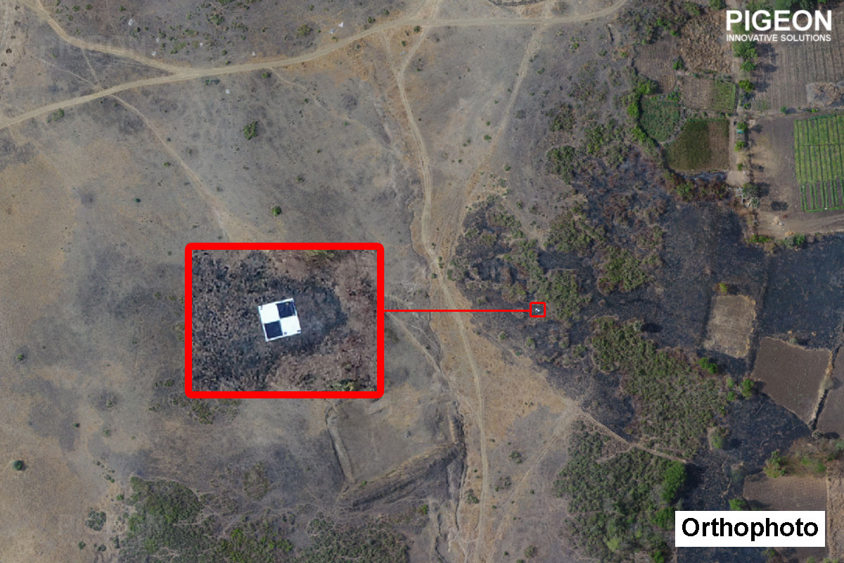
Georeferenced Orthophoto Generation
Digital Elevation Model (DEM)
Digital Surface Model (DSM)
Digital Terrain Model (DTM)
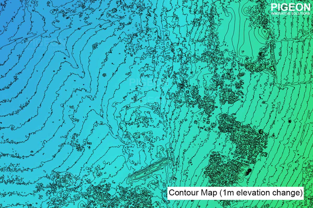
Contour map generation
3D Model Creation
3D model interactive video
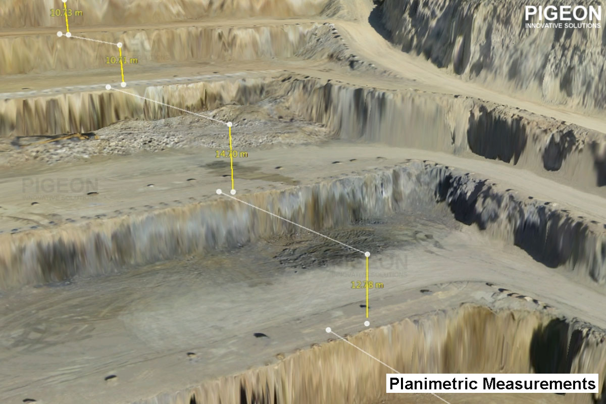
Planimetric Measurements (Distance / Height / Area / Perimeter)
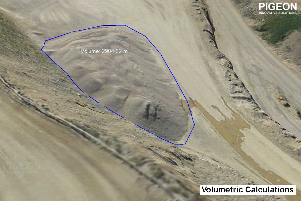
Volumetric Analysis (Stockpile analysis)
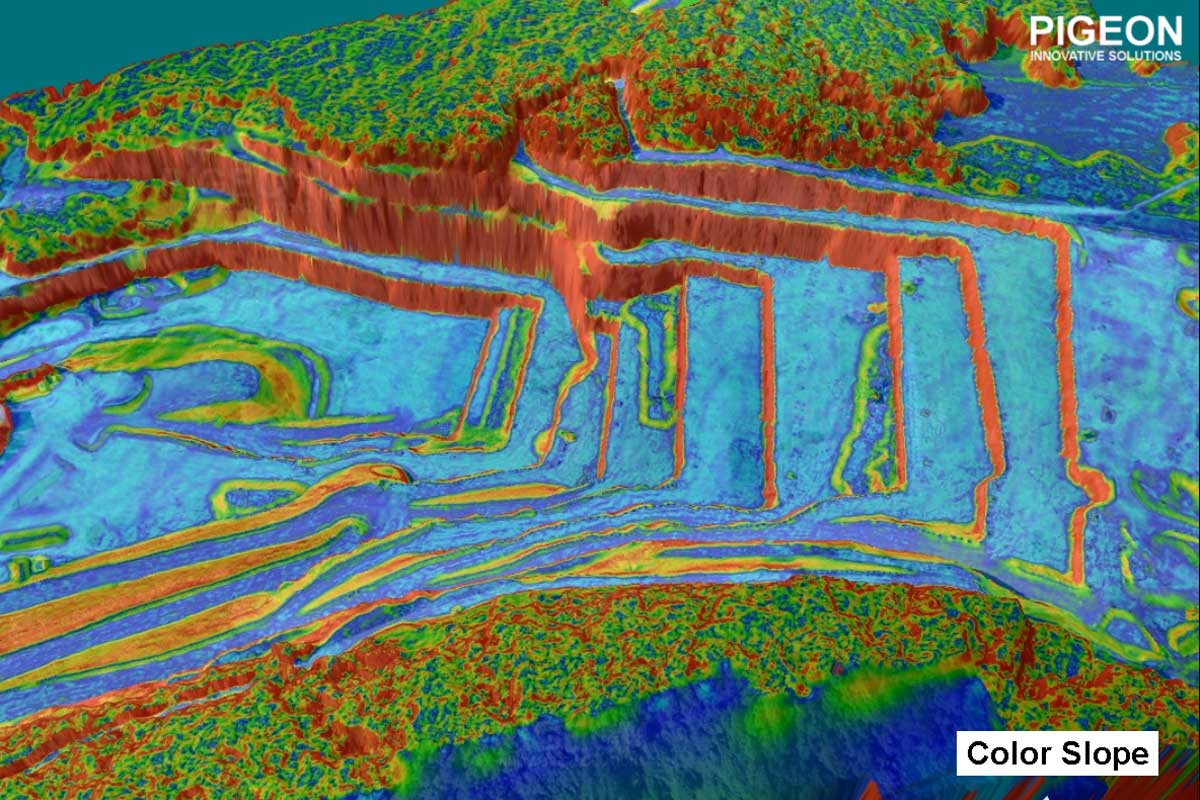
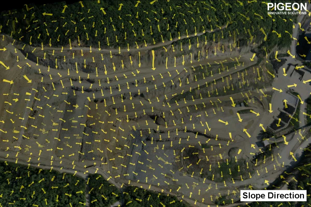
Slope Analysis
Feature Extraction and Indexing
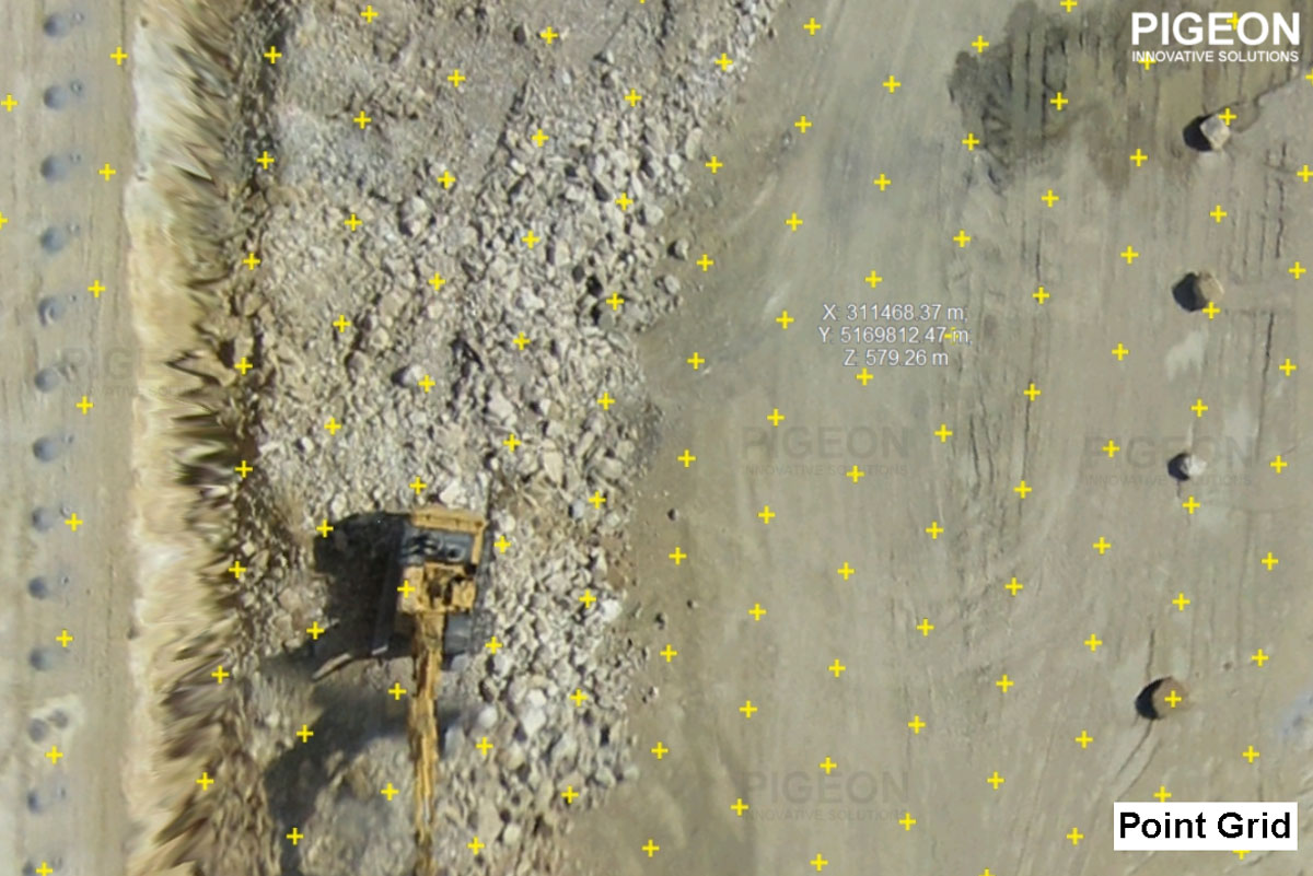
Digital Point Grid Generation
Agricultural Reflectance Maps
Infrastructure Defect Analysis
360 Panorama Creation
360 degree virtual tour creation
Aerial Photo and video editing
Anybody who has a drone and is a qualified licensed pilot can use our drone data processing services
Following industries can use this Data: Construction companies, Survey and Map making companies, Government organisations, Mining, Inspection, Consultancy firms, Agriculture, Land Planners, Law firms, Insurance companies, etc.