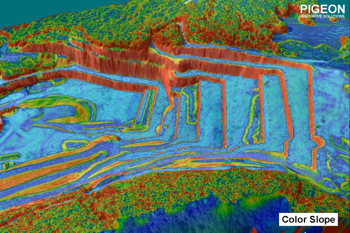
Slope analysis of Aerial Images by pigeonis
color slope analysis is done to understand the terrain profile in an interactive way

Slope analysis of Aerial Images by pigeonis
color slope analysis is done to understand the terrain profile in an interactive way
After 9 wonderful years and over 500+ customers served, we have closed our operations at Pigeon Innovative Solutions LLP.
This chapter may be ending, but the journey continues. Our team is now focused on solving bigger challenges and working on a larger mission, inspired by everything we have built and learned along the way.
For any queries, please write to us at:
contact@pigeonis.in
Thank you for being part of our journey.
The story doesn’t end here—it just grows bigger. 🌱