
Drones for forestry
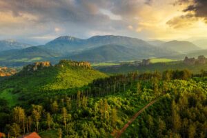
Forest ecosystems constitute about 31 percent of the entire world’s total biodiversity’s. Even since past times the areas of forests basically have, no human indulgence, making them difficult to reach at tough times.
The size of natural forestry is extremely extensive. Problems in the forest are difficult to be solved at human levels. Primary constraints of people adhere to travelling in such difficult regions. Forests in many parts of the world have trees soaring at large heights, and areas that are extremely marshy. This makes these regions inaccessible And create a rift between humans and these regions.
Why use drones in forestry?
The surfacing of the drone technology has eventually reduced many problems. Drones bridge the gaps by producing data in aerial photographs. Data about forest management, tracking crop health, understanding the activities happening in the forest and keeping a check on illegal invasions. The ultra-portable and lightweight drones for forestry management provide many benefits such as the ability to cover large areas swiftly and quickly and capture high-resolution images and videos that can be used for drone application in forestry.
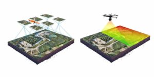
Mapping and Surveying become the foremost priorities of the drones application in the forestry domain. Measuring the volume and density of the forest and surveying the wildlife help in keeping check of the accurate data.
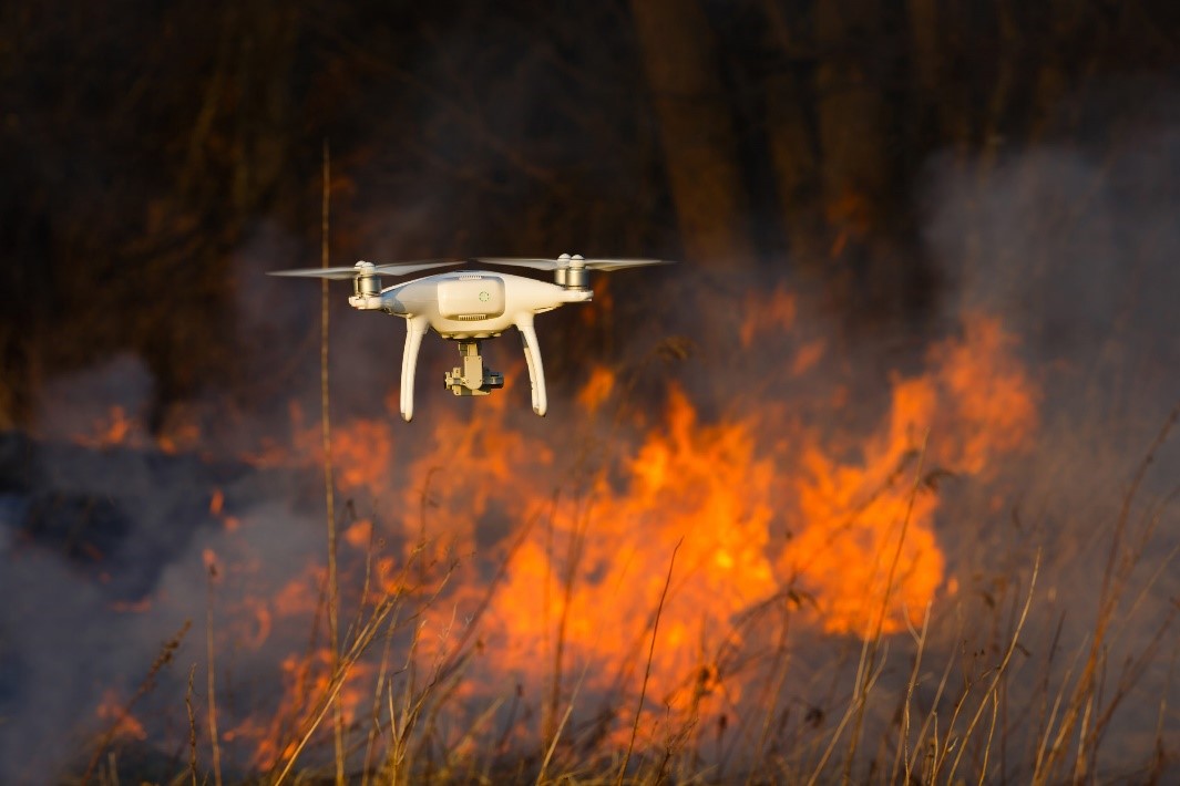
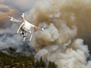
Drone technology has helped in gaining information about the origin and reason when there were brutal forest fires. Spraying of tonnes of water and carbon dioxides was a pro work done at times of emergencies.
Apart from this-
- Aerial surveillance by drone technology
- Photography with the help of drone technology
- Thermal imaging and
- Topography analysis are benefits of drones in forest.
This in turn helps in rendering information and generation of conservation schemes and balancing of the ecological model.
On using specialized LIDAR drones proper sensing of the entire forest takes place. This helps in gaining data about the shape of the tree and the total area it covers, the density of the leaves and its process of changing colours (seasonal changes). This in turn helps in understanding the region for further development.
Benefits of drones in forest protection
Now, let us dive deep into the benefits of using drones for forestry-
- The first and foremost point is that drones are extremely small in size as well as extremely light in weight and ultra-portable. This gives them a distinctive advantage over all the possible traditional methods of basically gathering aerial photography data. Now that we are using drones in forest, data acquiring processes can be much faster than something like a probably human or manned aircraft or satellites, without actually compromising on the resolution or clarity of the data. What actually gives drones and edge over all the possible methods is that were used earlier is that the amount of time that can be saved and the costs associated while conducting any kind of survey in the forest.
- Back in time focusing on a really small portion of the land which was actually needed to be given that much attention was considered a tedious task. But now with the help of drones, identifying the areas that need the specific attention can actually help in providing real-time data and information. This is the data about the health of trees, the vegetation, the animals surrounding and also the change of colour of the same forest seasonally. You’ll must not be aware, but drones can actually help in finding historical information about the forest like pest related diseases, identifying the reasons of the soil contamination and actually tracking or keeping a watch on the animal movement. The advantageous part is that a keen watch on the illegal activities is carried out in the forest regions.
- In ancient history collecting data by actually travelling through the entire forest site, navigating one’s way through the rugged terrain was a difficult task. Sometimes people used to get lost and a lot of time was wasted. Incidences have also proved that a lot many people have been infected by the various insects that rest in the forest, whilst the others had actually been attacked by huge animals. But ever since drone technology has been making its way to helping out all the people, collecting data in the forest has basically become a lot easier task. The amounts of enhanced safety can actually carry out research and rescue operations in forest and also in wooded areas. Nowadays one can go inside the forest come back safely because of drone application in forestry.
As we talked about earlier, Forest that have trees rising high up in the sky and extremely marshy grounds are regions that gave the least amount of flexibility. Such regions are those which are seen in the Amazon forest, the forests of Africa, and many other equatorial regions. Drones basically offer extreme flexibility when it comes to scheduling the surveys in these regions. Drones help in making these regions more flexible and easier to go about on a very day-to-day basis.
- The use of drones for forestry has basically helped in reducing the use of fossil fuels. All the drones that exist today basically function on batteries. This has basically reduced the amount of fossil fuels that were used by manned aircraft, vehicle that basically travelled down the forest to cater to the needs of collection of data. It is the drones in forest that helps in fighting climate change, by creating an atmosphere with zero emissions. The amounts of aircrafts or vehicles that were earlier used were not only expensive but also use a lot of fossil fuels. This eventually created harmful belts for the environment which has now started to reduce as drone technology in forestry, has started to increase.
Drone technology in forest basically helps in managing everything that has been a difficult task to be conducted by humans. It is because of the drones in forest that have actually helped in getting data full of precision and accuracy when it comes to special backgrounds as drones can fly very close to the ground and take images with high-resolution and videos that are accurate for mapping purposes.
Wildlife monitoring is a crucial component of conservation. Reliable drone surveys in the forests help to predict future trends and in turn understanding the viability of wildlife populations. On a general basis the drone surveys are done to count the number of animal species in the forests and keep a count on their declining numbers. This tells us a lot about predatory behaviour and transmission of diseases in the forests that have their origin because of the animals.
On a concluding note, from surveying the forests to understanding the life of wildlife in that region drones are used in forestry in all the major aspects